Rock Street: Difference between revisions
Appearance
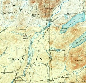
Migratebot (talk | contribs) Created page with " right|right|thumb||Rock Street<br>|Details from the 1911 Lyon Mountain USGS map, top<br>|and the 1989 Lake Placid USGS map, bottom<br>'''Rock Street''' leads from the north end of the Franklin Falls Road 5.4 miles to Alder Brook Road near Saint Rose of Lima Cemetery in Alder Brook." |
Migratebot (talk | contribs) No edit summary |
||
| Line 1: | Line 1: | ||
[[File:Rock%20Street.jpg|right|thumb||Rock Street<br>|Details from the 1911 Lyon Mountain USGS map, top<br>|and the 1989 Lake Placid USGS map, bottom]]<br>'''Rock Street''' leads from the north end of the [[Franklin%20Falls%20Road|Franklin Falls Road]] 5.4 miles to [[Alder%20Brook%20Road|Alder Brook Road]] near [[St.%20Rose%20of%20Lima%20Cemetery|Saint Rose of Lima Cemetery]] in [[Alder%20Brook|Alder Brook]]. | |||
Latest revision as of 21:31, 16 November 2024

Rock Street leads from the north end of the Franklin Falls Road 5.4 miles to Alder Brook Road near Saint Rose of Lima Cemetery in Alder Brook.